There is no neutral way to talk about the most contested place in the world: a land where seemingly noble ideas like safety and freedom turn into injustice depending on whether one is speaking east against the valley or west towards the sea. With no international consensus on its status, the West Bank of the River Jordan is a land in Limbo: an earthly impasse with neither heaven nor hell in sight.
It’s odd that such a holy place is so rife with malaise. Odder still that navigating in and out of the territory is easiest for those who don’t have a connection to this area. For the Palestinians living here, the sole way to leave the West Bank is through Jordan. And for the Israelis, it is forbidden to enter cities under the control of the Palestinian National Authority—the governing body commonly known as the State of Palestine.
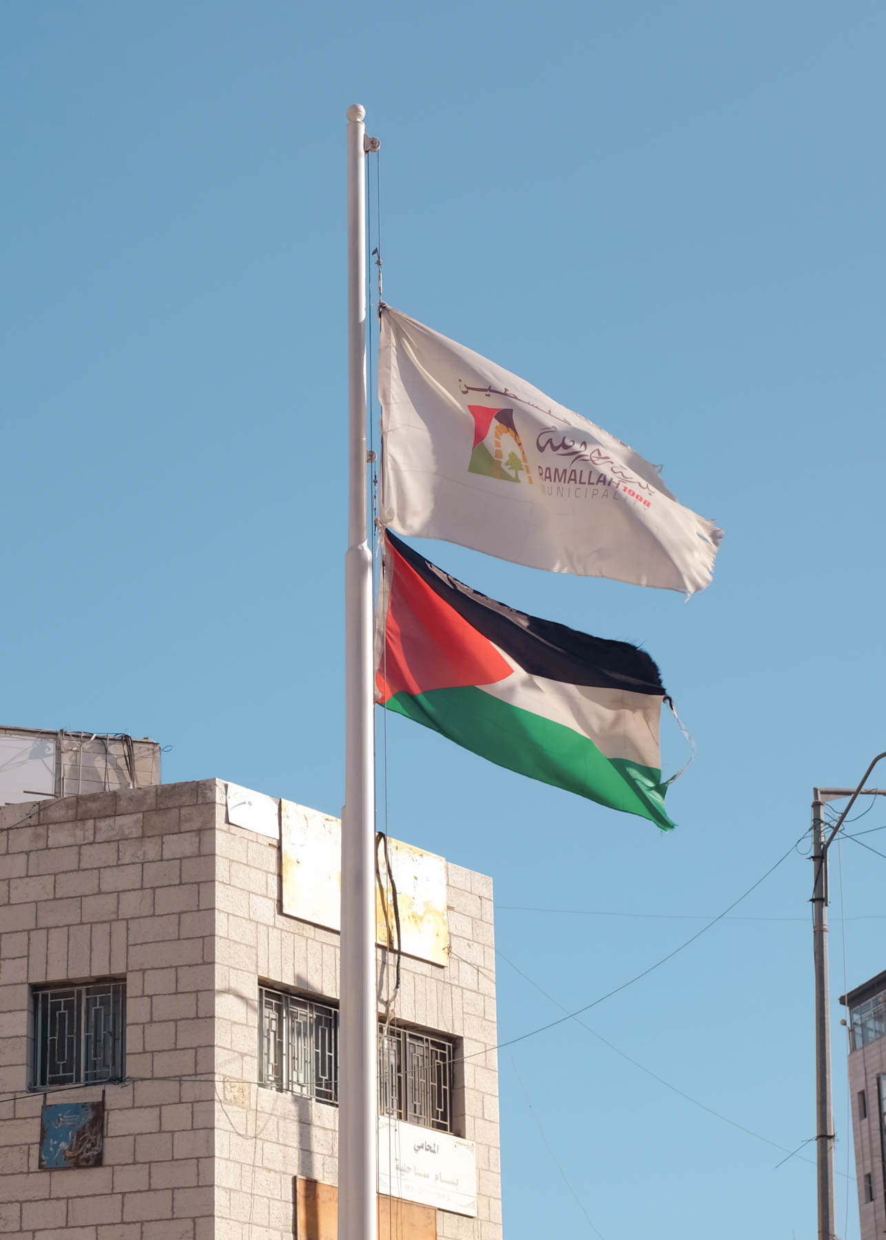
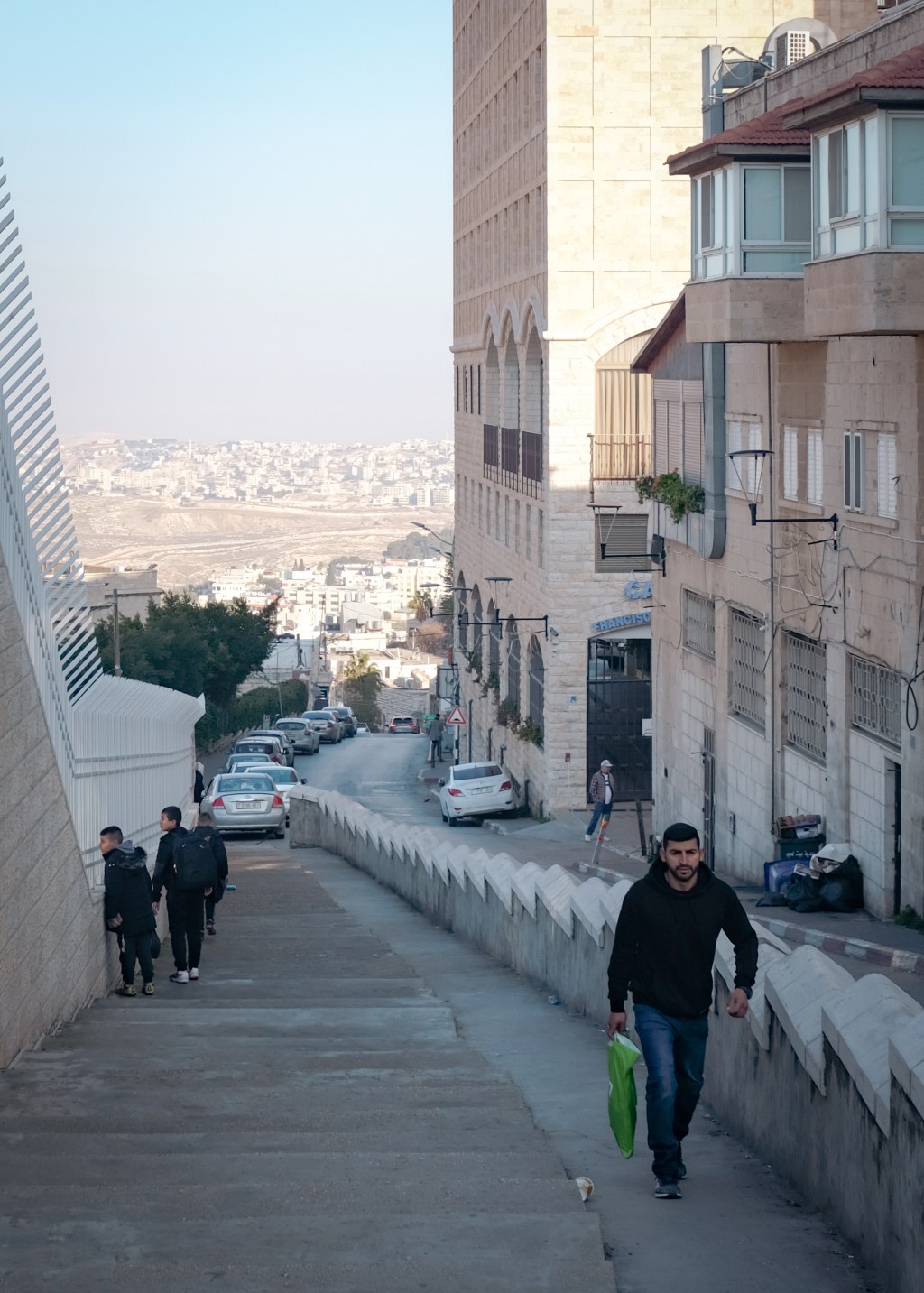
From the de facto capital Ramallah, the Palestinian Authority asserts a limited influence over the territory. Since 1995, the West Bank has been divided into three administrative divisions: Area A, cities and urban zones fully controlled by the State of Palestine; Area B, villages and surrounding lands that are under joint Israeli-Palestinian control; and Area C, rural parts of the West Bank where Israel exercises full civil and security control. Drawn around population centers, the Palestinian-governed Areas A and B form a collection of isolated enclaves. Amidst the Judaean Mountains, its residents live on a political archipelago.
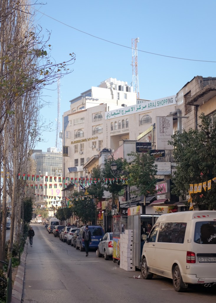
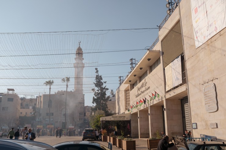
Ramallah is young compared to the other cities of the Holy Land. With a modern history dating back to only the 16th century, its significance grew rapidly towards the end of the 20th century. Following the separation of Jerusalem’s Old City from the West Bank and the implementation of travel restrictions on West Bank Palestinians into Israel, Ramallah—located some miles north of the holy city—rose to become the new Palestinian central hub. The city feels bigger than it actually is, due to its contiguity with the neighboring Al-Bireh. According to some, the latter was the location where Joseph and Mary noticed that the young Jesus was missing after having left Jerusalem following Passover.
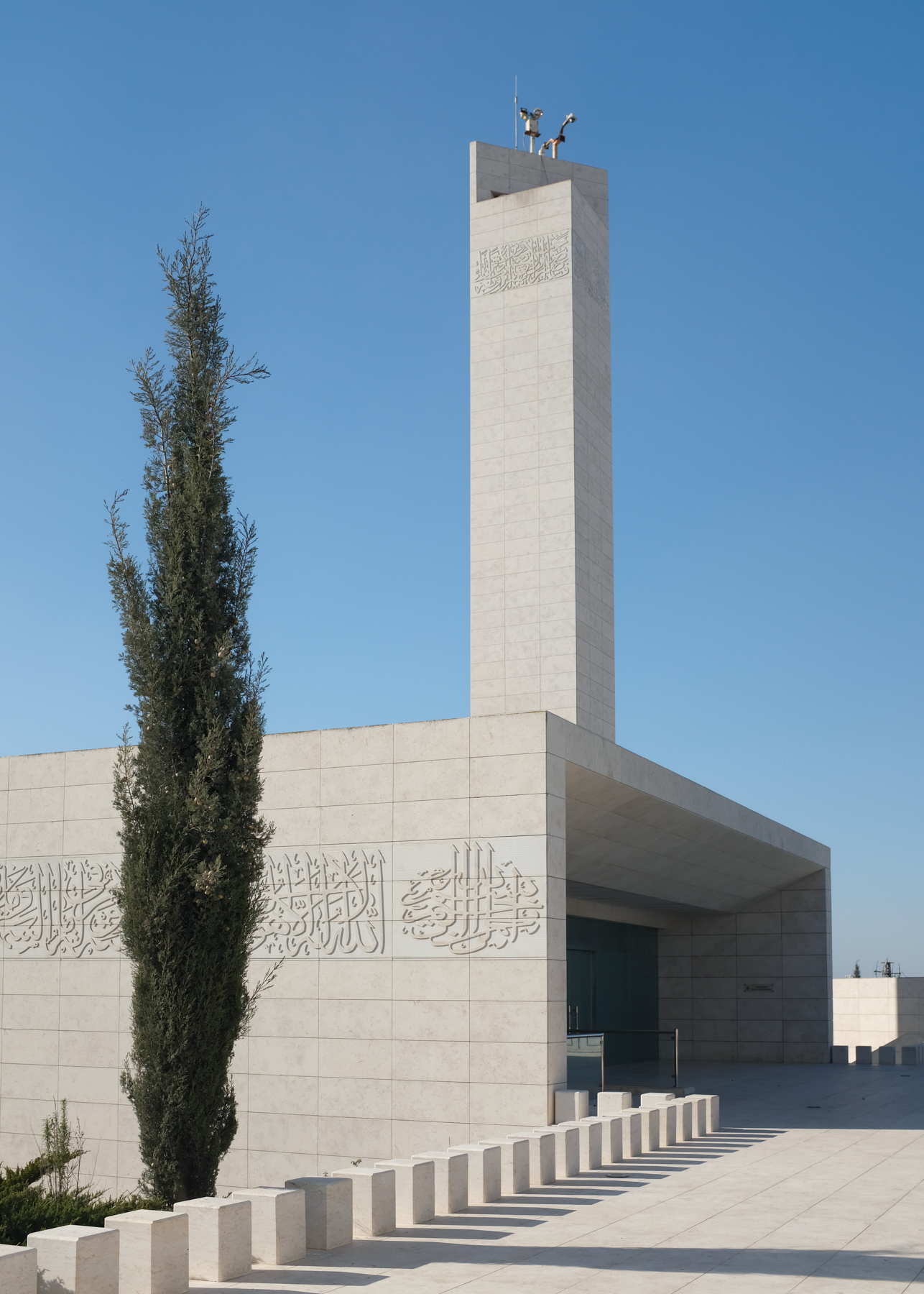
Straddling the twin cities is the Mukata’a—the West Bank’s official headquarters—as well as the site of the Arafat Mausoleum where the former President of the Palestinian National Authority is interred. Venerated and vilified, there has been no one else in recent history more closely associated with the Palestinian endeavor for sovereignty. The light-filled stone chamber is minimalistic and straightforward, meant to represent the conceptually simplistic wish of a people for their own state. It was also designed to be altered. As Arafat’s will was to be buried in Jerusalem, Ramallah is only a temporary resting place.
Along the highway, ancient cisterns punctuate the scorched earth. Natural springs are few and far between, and like elsewhere in the Middle East, water requires careful rationing and management. But the cisterns here are empty. Along with much of the West Bank’s agricultural lands, they lie in Area C, beyond Palestinian control. The surrounding soil is fertile and capable of crop, but their inaccessibility impoverishes a civilization for which agriculture has always been a mainstay.
Further east, in the Jordan Valley, alternating glimpses of Bedouin camps and Israeli caravans paint a sec portrait of the region’s wanderers and settlers. The Bedouins, known for their desert-dwelling and nomadic lifestyle, traditionally uproot their tents throughout the year depending on the availability of water and pastures for their livestock. In 1948, the establishment of the State of Israel displaced a majority of the tribes living in the Negev Desert. Many Bedouins flocked to the West Bank, which was then a part of Jordan. Over the decades, some communities have been moved to townships and urbanized to make space for the growing number of Jewish settlements in Area C, which Israel administers under a more sentimental name: the Area of Judea and Samaria. The strings of caravanim, portable metal buildings used as living spaces, are thus the first seeds of a new Israeli settlement, and a growing impediment for any future of a self-governing Palestine.
As enduring as the Israeli-Palestinian conflict is, it is a modern animus, birthed by men of the 20th century. Prior to the First World War, all the lands of the present-day Palestinian territories, Israel, and Jordan were administered as a part of the region of Syria under Ottoman rule. The city of Jericho, whose walls have stood and toppled 23 times with the ebb and flow of empires, has seen it all. Long before Allah and before the Bronze Age storm deity Yahweh rose above all others to become the one true God, Jericho was a center of worship for a Semitic moon god, Yarikh.
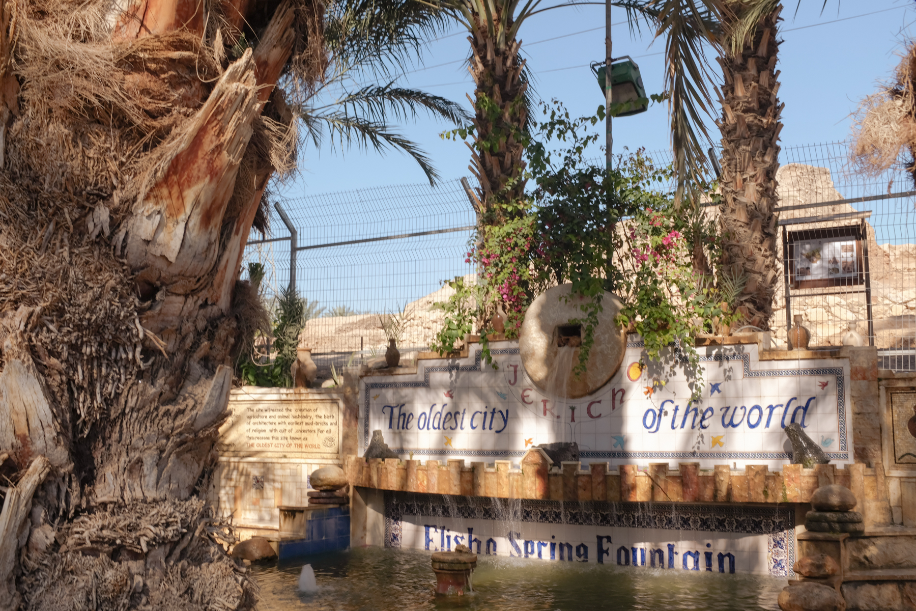
It is not Jericho’s 11,000 years of archaeological secrets or its biblical significance that draws Palestinians to its perimeters. Today, the city serves a very practical civil function: it is the only avenue for West Bank Palestinians to travel abroad. Since 1995, the Palestinian Authority has issued passports to its residents. But without an airport of their own, West Bank Palestinians must travel to the Jordanian capital of Amman. And to reach Jordan, they must cross the Allenby Bridge near Jericho. A crossing is never guaranteed. Israeli authorities can deny any Palestinian the right to leave the West Bank if there is suspicion that the traveler poses a threat to national security.
In the Bible, Jericho is described as a city of palm trees. In that respect, little has changed. The fanned leaves are washed with the color of the sun, but they are a refreshing contrast against a backdrop of monochromatic khaki. It is common knowledge that everything in Jericho grows better. For millennia, the nearby natural spring of ‘Ain es-Sultan has made the surrounding area a rich desert oasis. Another fortuitous factor is its elevation: at 250 meters below sea level, Jericho is the lowest city in the world, and the extra oxygen in the air is credited for producing bountiful, sometimes miraculous yields.

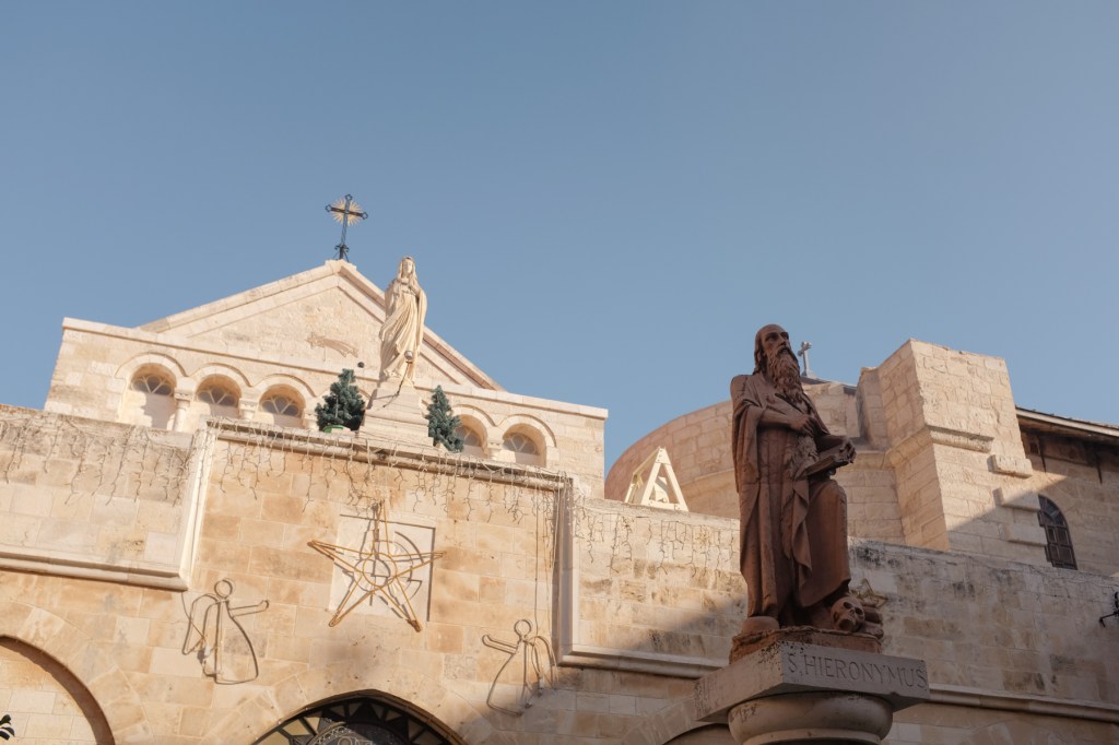
When it comes to miracles, Bethlehem can lay the best claim of all the cities and towns in the West Bank. No other place in the territory can compete with the birthplace of Jesus. Of particular interest to pilgrims is the Church of the Nativity. Commissioned by Constantine the Great, the first Roman emperor to convert to Christianity, the holy site is believed to have been built above the grotto in which Mary gave birth to Jesus. Directly adjacent to it is the original manger, marking the site where the newborn Christ was swaddled and laid to sleep.

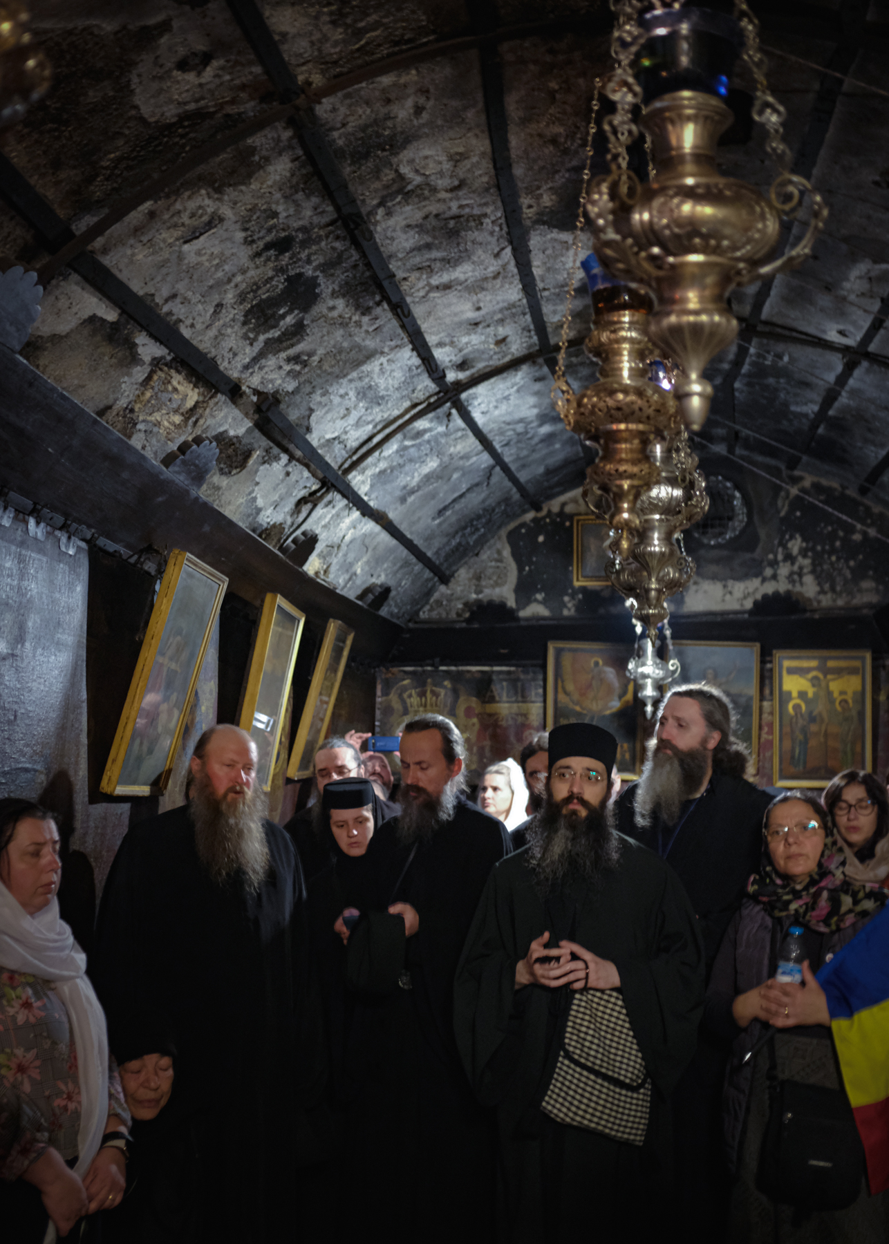
Analogous to the rest of the West Bank’s politics, division is rife under the roof of the basilica—not between Jews and Muslims, but amongst the various denominations of Christians. The custodianship of this UNESCO World Heritage Site— the first one listed under Palestine—is split between the Greek Orthodox Church, the Armenian Apostolic Church, and the Franciscans of the Roman Catholic Church. Sharing a single place of worship is not easy, especially for God’s most faithful. Over the years, scuffles between the sects have sent more than one clergyman to the hospital.
In the past, Bethlehem was a city of Arab Christians. Today, they make up only 12 percent of the population. Recent decades have seen a large exodus of the Palestinian Christian community from the West Bank, no doubt collateral damage of the tense political atmosphere in the region. Exacerbated by unpredictable interruptions to the city’s primary lifeline, tourism, many see emigration as the only solution.

To the north of the city is the West Bank Barrier, a colossal concrete leviathan that stretches more than 700 kilometers. Erected after a wave of violence in the early 2000s which came to be known as the Second Intifada, the barrier was introduced by Israel as a security measure. Since then, it has been regarded as a tactic to create new de facto borders, undermining previous peacemaking efforts and demarcation lines drawn in earlier armistice agreements. For the residents of Bethlehem, the wall is symbolic of a future stolen from them. Gone are sights of the fertile fields, the olive groves, and any space for the city to grow into. For a people who can see the Mediterranean Sea from their backyard, it has never been more out of reach.


Leave a comment